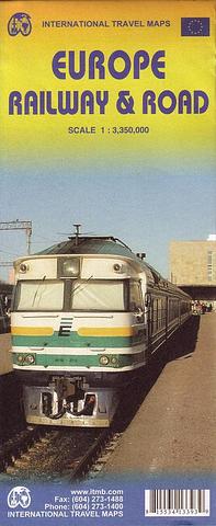
Europe Railway & Road Map
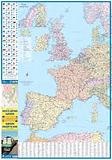
Most visitors to Europe travel either by tour bus or by using a rail pass. Although car rental travel is also popular, most maps of Europe do not show rail lines. Showing all passenger rail lines from western Ireland to east of Moscow and from Scandinavia to southern Italy is challenging. We feel that this map does a good job of showing high speed rail lines separately from regular lines, motorways and major highways, and all significant urban areas. Unlike the Thomas Cook map, this map is a political map showing each country in a different colour, and grades cities by different dots (London and Paris being orange-ish blobs). The market for this map, frankly, is the visitor to Europe, although residents of Europe should find it helpful as well. By adding roads as well as rail lines (while placing the emphasis on rail travel), those parts of Europe not having rail connections can still be explored (think of Sardinia, Corsica, Malta etc.). Ferry routes are also shown and the E classification highways are noted. Didn’t have room to show river cruises, but the rivers are included!
PRICE INCLUDES POSTAGE AND HANDLING

Connect with us...