Japan - folded map
Japan at 1:1,500,000 on a double-sided map from Nelles with a smaller size sheet offering a convenient format for use when travelling. Also included are enlargements showing in greater detail the environs of Tokyo – Yokohama, Osaka – Kobe, and Nagoya.
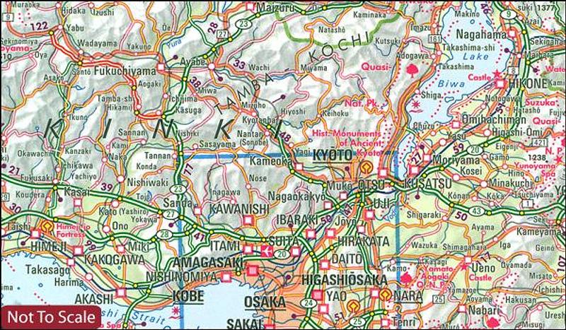
The map divides the country north/south with Tokyo shown on both sides. On one side is southern part of Honshu and Kyushu Island, plus the smaller groups of islands including Okinawa and the Sakishima Archipelago shown on separate panels. Insets show the environs of Osaka and Nagoya in greater detail. On the reverse is the northern part of Honshu and Hokkaido, plus an enlargement for the environs of the Tokyo – Yokohama area.
Topography is shown by relief shading with spot heights and names of mountain ranges. The map presents the country’s road and rail networks, with a separate list of expressways on each side. Local airports ferry connections are also marked. Overprint highlights various places of interest. The map has latitude and longitude margin ricks at intervals of 1° and is not indexed. Map legend includes English.
Price includes postage and handling.

Connect with us...